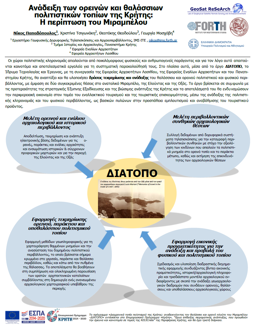
Οι χώροι πολιτιστικής κληρονομιάς απειλούνται από ποικιλόμορφους φυσικούς και ανθρωπογενείς παράγοντες και για τον λόγο αυτό απαιτούνται καινοτόμα και αποτελεσματικά εργαλεία για τη συστηματική παρακολούθηση των τοπίων και της πολιτιστικής κληρονομιάς.
The main objective of the work is to explore and document the ruins of the sunken city of Olounda, which represents the remains of the Minoan culture, one of the oldest Bronze Age civilisations in the Mediterranean, dating back to around 3000 BC.
Electromagnetic induction equipment (EMI) with a multi-frequency harmonic source of the Slingram type and small coil spacing, was initially intended for multi-depth electrical conductivity mapping.
https://doi.org/10.4000/archeosciences.9690
This paper aims to present “Cretan cultural landscapes over the time: promoting marine and mountainous environment of Mirabello – DIATOPO” (hereafter DIATOPO) a multidisciplinary research program exploring and documenting the cultural heritage of Elounda and its surrounding landscapes.
TMM-CH 2021 Conference program
It is well known that nowadays as well as in the past the vast majority of human habitation and activities are mainly concentrated in littoral areas. Thus the increased attention to coastal zone management contributed to the development and implementation of shallow-water mapping approaches for capturing the current environmental conditions.
https://doi.org/10.3390/rs13071237
Direct current electrical resistivity method has experienced significant breakthroughs during the last decades with the development of advanced instrumentation and sophisticated inversion algorithms. These have substantially benefitted the field of archaeological prospection to extract quantitative information for the buried archaeological material in a complete three dimensional (3-D) context.
https://doi.org/10.1002/arp.1841
The present study explores the applicability and effectiveness of an optimisation technique applied to Electrical Resistivity Tomography data. The procedure is based on the Jacobian matrix, where the most sensitive measurements are selected from a comprehensive data set to enhance the least resolvable parameters of the reconstructed model.
https://doi.org/10.3390/app11146394
This study evaluates the accuracy of bathymetric maps generated from multispectral satellite datasets acquired from different multispectral sensors, namely the Worldview 2, PlanetScope, and the Sentinel 2, in the bay of Elounda in Crete. Image pre-processing steps were implemented before the use of the three empirical methods for estimating bathymetry.
https://doi.org/10.3390/rs14030772